The idea of 'prehistory' is, basically, anything that happened before the invention (or perhaps development would be more accurate) of writing. This is, of course, an incredibly facile way of putting it, but it is as convenient as the Three-Age system for explaining this period in a rudimentary way. But for the sake of convenience, let's call 'prehistoric' anything that came before the Romans (and feel free to lynch me later!). If you were taught anything about this topic in school at all, first of all you are very lucky, and secondly you were probably taught the Three-Age system of Stone, Bronze and Iron Ages. The brainwave of the Danish scholar Christian Jurgensen Thomsen, who from 1816 was curator of the Danish Royal Commission for the Collection and Preservation of Antiquities, this system was used from the 1820s to classify artefacts presented in the museum there. It is based on the principle of stratiography, which basically involves studying the layers of historical buildup. In this way, Thomsen was able to identify that layers containing iron implements occurred higher up than those containing bronze artifacts, which in turn was above a layer of stone objects. It was all very neat and highly effective, and has formed the backbone of historical approach for over a century since its inception. Thomsen's Stone Age was further subdivided in 1865 by the English historian John Lubbock into Paleolithic and Neolithic, or Old and New Stone Ages. Controversially, a Mesolithic (Middle Stone Age) was added to the mix the following year. It was controversial because some scholars didn't see the need for it, but others did. Additions such as the Copper Age into the Bronze Age have met with similar scepticism. It all boils down to whether such an age 'happened' in a particular area, for example the use of copper was more pronounced around the Mediterranean and Africa, while Bronze flowed more organically into Iron in Britain. But I digress.
To talk briefly about dates, the Three-Age System is famous for being so terribly wrong about dating when it was first introduced. The Stone Age is the longest period, spreading from the end of the Ice Age to roughly 2500BC (the Neolithic, which is the important bit for this blog, stretches from 4000BC to 2500BC). The Bronze Age then lasts until about 800BC. The Iron Age then lasts until the Romanization of Britain, which was accomplished by about 100AD.
Prehistoric Britain exists all around us, with standing stones jutting out of the ground all over the countryside, and chambered tombs tucked into shady corners of modern housing estates. But there are several 'prehistoric landscapes' where great swathes of the country are kept as once they were, and it doesn't take much imagination to feel a tremendous resonance with the past. Remote in both time and space, places like Mitchell's Fold and Bryn Celli Ddu hold a special fascination for me. Larger landscapes, such as the justly-famous Stonehenge and Avebury sites in Wiltshire, even with the close proximity to the modern world, and the super-attraction tourist status they have, still have the power to evoke a certain something.
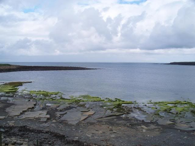
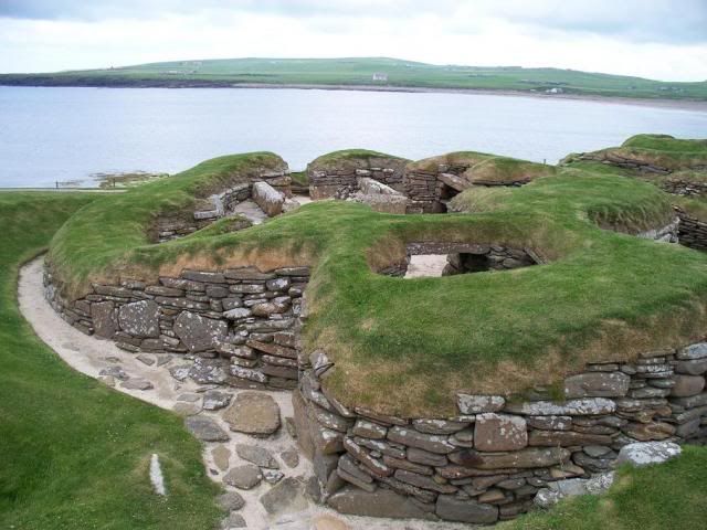
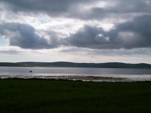
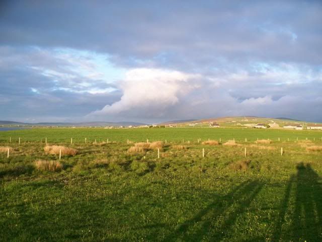
Orkney, however, is a particular favourite of mine. A collection of 90 islands off the north coast of Scotland, the islands are made of Old Red Sandstone, which is excellent for building with as it can be quarried into blocks with ease. Perhaps it was this very fact that led to prehistoric folks settling here all those years ago. From about 3500BC it is believed the islands were being settled, as the hunter-gatherer way of life settled down into farming. Evidence of this settled way of life is provided by one of Orkney's most famous monuments, Skara Brae:
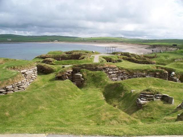
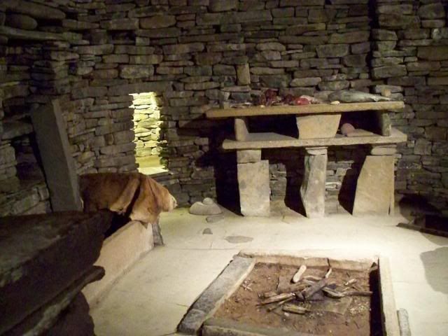
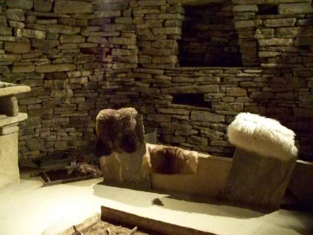
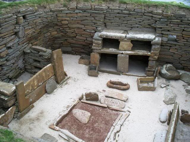
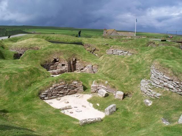
A Neolithic village that owes its amazing preservation to a storm dumping sand over it sometime in the distant past, Skara Brae really does deserve all of the praise it gets. Dating from about 3100BC, there are some 10 houses on show today, though it is believed only 6-8 of these would have been occupied at any one time. They are all built to roughly the same plan, with a large dresser facing the door and beds off to either side of the central hearth. The houses are connected by a winding, covered passageway, which was accessed by a single point of entry into the village.
The most intriguing thing about the village, though, is that it is built into a midden, or rubbish heap, presumably for protection from the weather, insulation, or both. Coastal erosion probably means it was a lot further inland when first settled than it appears today, but those Orcadian winds no doubt still packed a punch for anything built free-standing on the islands. Using the midden heap, hollowing out the bits required for living, would therefore shield the houses from these winds.
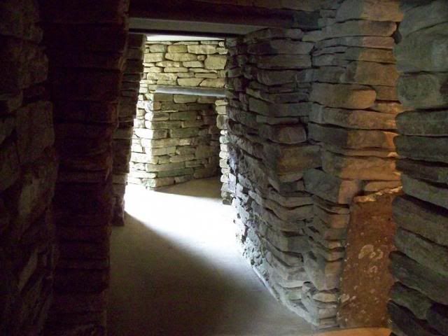
I'm sorry, I've deceived you all slightly with these last few photos - you can't actually wander around Skara Brae in the sense that I might have suggested here. Instead, a viewing pathway is built around the site, where you look down on it from above. Historic Scotland, who care for the village, have kindly constructed a modern replica so that you can get the feel for the site. Which is rather marvellous, really!
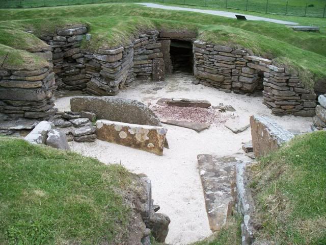
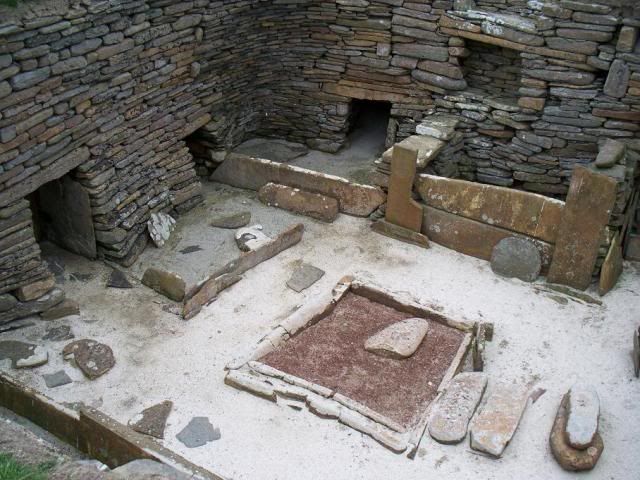
As I said above, there are ten houses on show, each built along the same lines. Nine of them are roofless, with one that is too delicate to remain open to the elements so has been covered sympathetically with a turf roof. The dressers, beds, stone boxes and 'cells' in the walls are all fairly standard features that make this almost the Barratt Homes estate of the Neolithic. The 'cells' show another advantage of building into the midden, that you can scoop out segments almost at will to create additional storage space as required.
The site is really just fascinating, its appeal for me stemming from the fact that this is where our ancestors lived. Monuments like the aforementioned Stonehenge, or the burial chambers that pepper the Cotswolds and Anglesey, were built as monuments for posterity (for whatever reason), but these houses were built to be lived in, with all the intimacy that such a purpose entails.
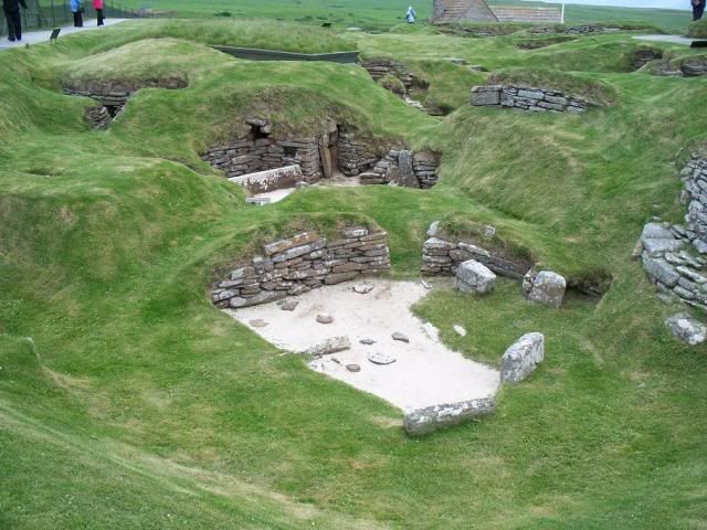
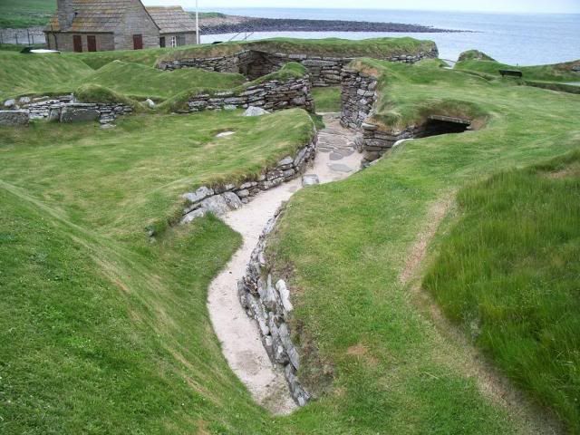
The issue of roofing has caused some debate. Clearly the houses weren't roofed with stone, as there were no stone slabs found within the houses that would imply a collapse. Timber (or perhaps whalebone) struts have been postulated, perhaps forming a frame that would be covered with turf for further insulation. The 'streets' that link the houses were covered with stone slabs, as can still be seen in many parts of the village.

It is, without a doubt, the best-preserved settlement in Northern Europe. Occupied for about 600 years, it was abandoned for unknown reasons. The man in charge of the initial excavation, Professor Gordon Childe, suggested a massive sandstorm forced the people to leave - giving rise to Skara Brae being sometimes referred to as the "Scottish Pompeii". There is no evidence of any catastrophe here, in fact there is no evidence for why the people left at all. It did, at any rate, lie buried on the shore until a massive storm in 1850 uncovered the midden. Perhaps the dramatic way in which it was revealed had implied an equally dramatic end for the site all those centuries before.
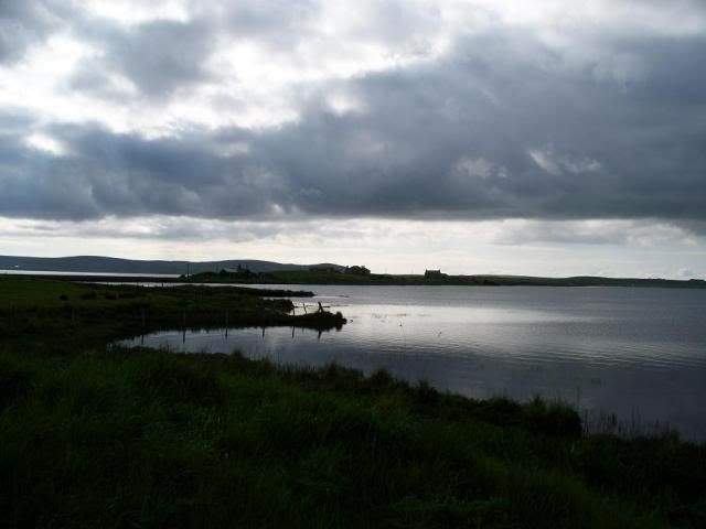
Skara Brae isn't the only prehistoric settlement on Orkney's mainland, however. On the shores of Loch Harray lies the remains of Barnhouse settlement. Not as impressive as Skara Brae, of course, it is nonetheless an interesting site for revealing the domestic lives of prehistoric man.
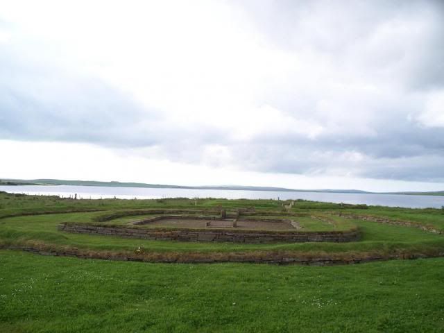
Barnhouse was settled by about 3200BC, and is believed to have been in use for 400 years, with many of the houses undergoing modification during this time. The low foundation walls seen here are modern reconstructions based on the archaeological discoveries, but serve to illustrate how they were built along similar lines to those at Skara Brae. The most striking difference between the two sites, however, is the size of the houses. At Skara Brae the houses are modest, enough space for one family to live in relatively cosy comfort. Here at Barnhouse, however, the interior space is markedly larger. Whether this is the advantage of not building into a midden heap, or whether it reflects a social trend for desiring larger living space, who knows.


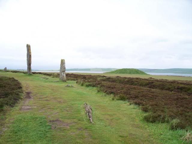
The house above has what appears to be an entrance porch before you arrive in the single room, again with a hearth in the centre, though there is no real evidence the house was ever occupied, though food preparation took place outside. This leads archaeologists to believe this was associated with rituals of some sort. At Barnhouse, though, can be seen a very interesting parallel with the nearby Stones of Stennes, a theory that has intrigued me since I heard it nearly five years ago.
The Stones of Stennes form part of the vast ritual landscape that forms The Heart of Neolithic Orkney World Heritage Site. Barnhouse isn't included in the listing for some odd reason, but is very close to the Standing Stones. More odd is the fact that the houses at Barnhouse appear to provide a blueprint for the Standing Stones themselves - during excavations, a hearth was discovered within the ring. This is all very odd, and serves to highlight something that I think is very important to bear in mind when reading about Prehistoric monuments.

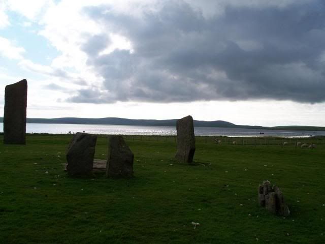
The hearth in the centre of the stones is incongruous, to say the least. Hearths are associated with domestic life, as it was quite literally the centre of the home, and Stone Circles are associated with ceremonies concerning the commemoration of the ancestors - that is, places of the dead. There is a theory that the Standing Stones monument was erected atop someone's house, perhaps a pillar of the community. The hearth in the centre is the hearth of the original house, and the standing stones form the original house's supports.

Is it plausible? Well, of course. But it is just a theory, and it serves to highlight the fact that we basically don't know enough about prehistoric life to know anything for sure. It's something I discussed a while ago in a blog about the same sort of topic. The hearth may have been there from a previous house, and the stones were assembled here long after the house was gone. Or it may have been purpose-installed within the finished ring of stones for specific rituals. It may be a Neolithic prank. Who knows? I live in a flat that, apparently, is built on the site of a chapel. In thousands of years' time, when I assume this flat will no longer be here, will the archaeologists of the future find remnants of both structures and think the British of the 21st century had a very close relationship with religion because we lived within the confines of our sacred spaces? Hm. Terry Gilliam's animation that opens the Monty Python sketch "Archaeology Today" leaps instantly to mind. I digress once again!
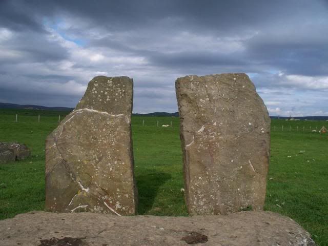
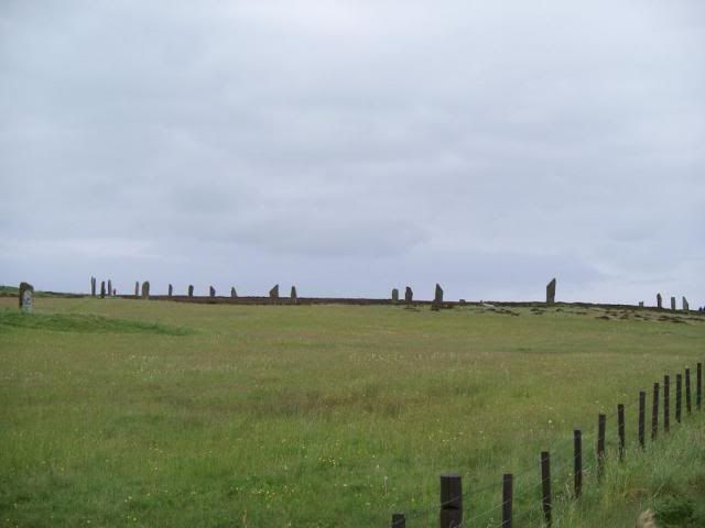
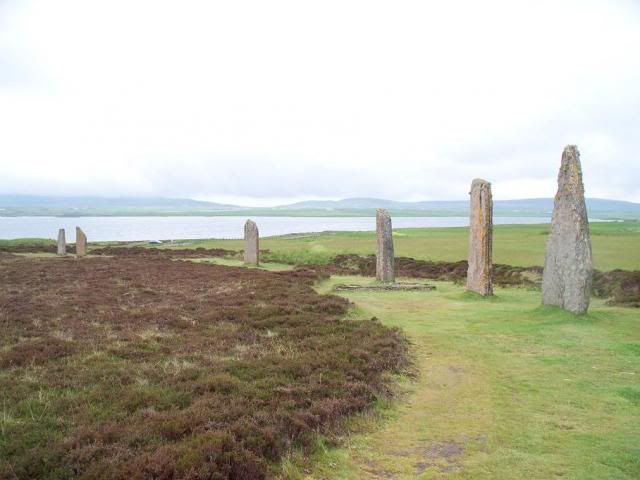
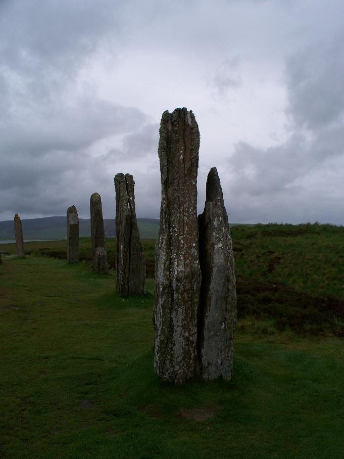
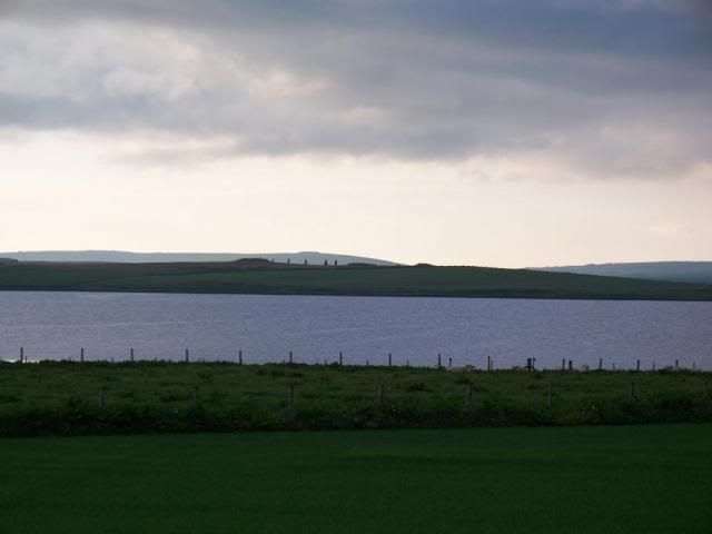
Barnhouse and the Standing Stones are very close, and were in use around the same period of time, which means it is plausible that the people of Barnhouse built and used the Standing Stones. To what purpose, of course, remains a mystery. Trying to explain Prehistoric religious practices is, in the words of Francis Pryor, like trying to explain the purpose of the cross without knowing the story of the crucifixion. Whether there is some element of veneration of ancestors, which seems to be the the accepted theory as put forward by Mike Parker Pearson, we could never categorically say. Such is the mystery of a civilisation predating the use of writing. What we do know, however, is that the monument would have been quite striking to look at when originally constructed - twelve stones set in marshy land, surrounded by a henge (an earth bank), with a causeway providing the only way to enter. In fact, the Standing Stones are believed to form the earliest henge monument in Britain.

Stennes is part of the Heart of Neolithic Orkney site, as mentioned, and forms roughly the centre of the site. To the east is the great chambered cairn of Maes Howe, and to the west, the Ring of Brodgar.
Described as "awesome" by Dr Pryor, Brodgar is massive, the third largest stone circle in the British Isles. The path from Stennes to Brodgar begins at the immense Watch Stone:

The 'processional way' continues on to the circle itself:
Like many prehistoric landscapes, there is believed to have been an avenue that links the circle to the other sites. The above Comet Stone is possibly part of that, which would have been paired with another stone in a pattern that would have perhaps been repeated all the way to Maes Howe.
Brodgar is a little younger than Stennes, and is believed to have been associated with commemorating the dead. However, it hasn't really been properly excavated, and while nothing has been discovered so far, it is really unknown what purpose it had in the context of the other monuments here.
What is clear is that Brodgar is very obvious in the landscape, the stones stand out against the sky quite dramatically:
Proceeding back towards the Stennes monuments across the narrow isthmus of land, you also pass a very interesting monument that is still currently under excavation (excavations that began after my trip, so I have no pictures of them sorry!). The Ness of Brodgar excavations have revealed some massive structures that have been likened to a Neolithic Cathedral, vast open spaces much bigger than the houses at Skara Brae or Barnhouse. The idea that the Ring of Brodgar can be seen for miles around perhaps makes the structures discovered on the Ness a kind of Neolithic boarding house. If you have a structure that can be seen for miles, and attracts people from all over the island(s), then perhaps they used these structures as a base when taking part in ceremonies at the monuments here. Well, it's just a theory!
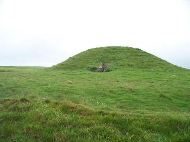
Maes Howe is an immense chambered tomb that seems to form a focal point for the monuments here. Believed to be as much as 5000 years old, it is 7m high and 35m in diameter, and surrounded by an outer ditch.
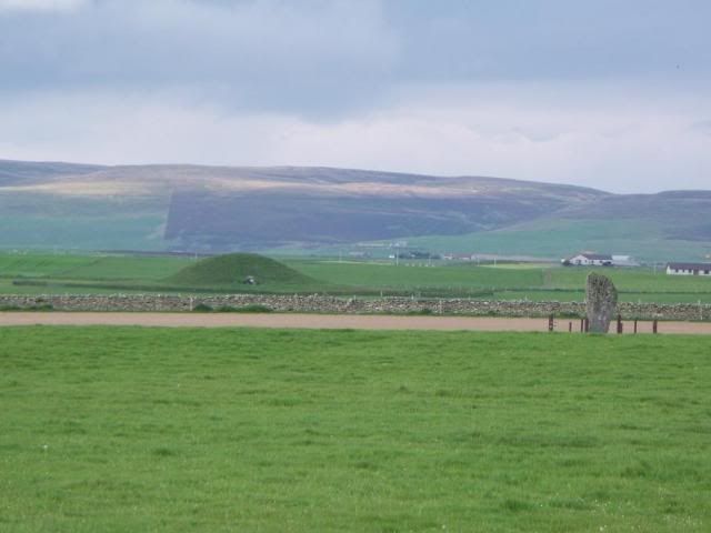
Excavations in 1990 discovered what has been called a 'drain' in front of the entry, which has fueled the idea of the monument being built atop an earlier house much like the Standing Stones. The opening, which can be seen in the above photo as a white speck, is famous for lining up perfectly with the setting sun around the Winter Solstice, which also aligns perfectly with Barnhouse Stone. Just how accurate such alignments are is always something I find myself feeling sceptical about, given how much the earth has been jolted around given the number of seismic events that have occurred in the thousands of years since these monuments were constructed. Because they line up with the sun now, doesn't necessarily mean they did then. Hm.
Maes Howe is also renowned today for a celebrated event in about 1150AD, when marauding Vikings broke into the tomb in an effort to find treasure. The event is partially recounted in Orkneyinga Saga, a cracking (if heavy-going) read about the adventures of the Vikings in this part of the world. On their way back from a pilgrimage to Rome and Jerusalem (many Vikings by this time had adapted to Christianity, though not all of course), they broke in here initially to shelter from a snowstorm. Rumours of treasure hidden in the mound caused it to be broken into again over the years, as a lot of runic graffiti attests!

The whole landscape here is associated with prehistoric ritual, which lends it an atmosphere that is somehow redolent of ancient ceremony. One imagines celebrants, possibly having journeyed from miles away, lodged at the Ness of Brodgar, taking part in mystical rites in the height of midwinter at the Ring of Brodgar. Proceeding with reverence down the avenue, they arrive first at the Stennes Standing Stones, before passing further to the ultimate goal of Maes Howe. More ceremonies would take place, perhaps in burial of an important member of the community, before returning to the Ness for feasting and commemoration. Then, the festivities over, the pilgrims disperse back to their homes, perhaps on the coast at Skara Brae, or more closer at Barnhouse, until the next important event in the annual cycle.
It is a very potent thought, but unfortunately it is really no more than an educated guess. The monuments we see today did all stand at the same time, and it is therefore feasible that they were used in some sort of inter-connected manner. But sometimes it seems that we perhaps project too much of our own expectations onto our forebears. Because we enjoy a good parade today, with a lot of pomp and a good pilgrimage thrown in, doesn't necessarily mean they did, too. The great stone monuments at Brodgar, like their Wiltshire counterparts, could just as easily be market squares. The archaeologist-trap of ascribing anything we can't explain to the category of 'ritual-funerary' could be at work at any number of sites.
When we think of the commemoration of the dead in the context of prehistoric monuments, we traditionally describe a processional route from east to west, mirroring the passage of the sun through the sky. Going 'into the west' has very strong connotations as a synonym for death. This is the route described at Stonehenge, where the procession travels west from Durrington Walls, along the River Avon, to Stonehenge itself. But at the Brodgar-Stennes landscape we have the opposite going on, where we have a commemoration of the dead where we travel into the east. Perhaps this means the landscape was associated more closely with rebirth, and so would be a big part of religious ceremony during the winter to ensure a plentiful harvest in the coming year. But this doesn't really feel right, either.
Prehistoric religious practices are as unknown to us as the strangest of any mysteries. But it is precisely because of this remoteness in both time and space that constitutes its enduring fascination for me.
I hope this has whetted the appetite for more prehistory among you all - coming soon will be a more exhaustive look (hopefully) at our ancient past!
No comments:
Post a Comment