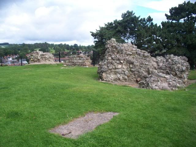
Oswestry, almost on the border with Wales, is the site of one of the biggest hillforts in the country. Hillforts are traditionally thought of as Iron Age enclosures, demonstrating a massive shift in the way societies existed in prehistory. I am planning to entertain you all with a Prehistory blog soon enough (I can hear the cheers already), so won't dwell on this for the moment.
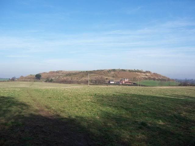
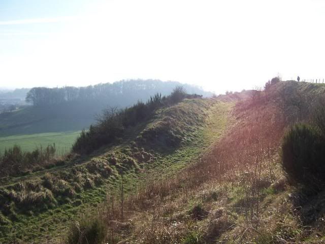
Iron Age Britain was studded with hillforts of this sort much like Britain today is studded with towns, which is really how hillforts should be thought of. More accurately, I suppose, they were more like villages, as each fort would only support a small group by today's standards. The ramparts of Old Oswestry enclose an area of 21 acres, less than half the size of the formidable Maiden Castle down in Dorset.
There is evidence of some Bronze Age occupation of the site, but the first phase of rampart-building seems to be dating to the sixth century BC, well into the Iron Age. As the centuries wore on, the ramparts were strengthened and increased, which may suggest increased importance for the site. It hasn't been proven with any real conviction, but it seems the hillfort was the site of a local stronghold for the Cornovii tribe.
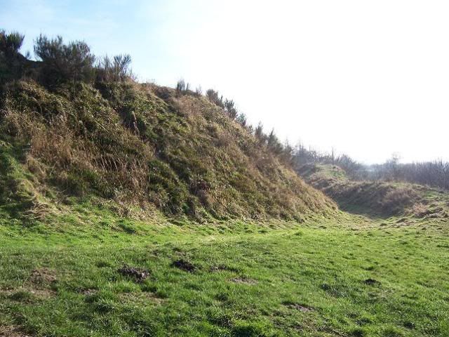
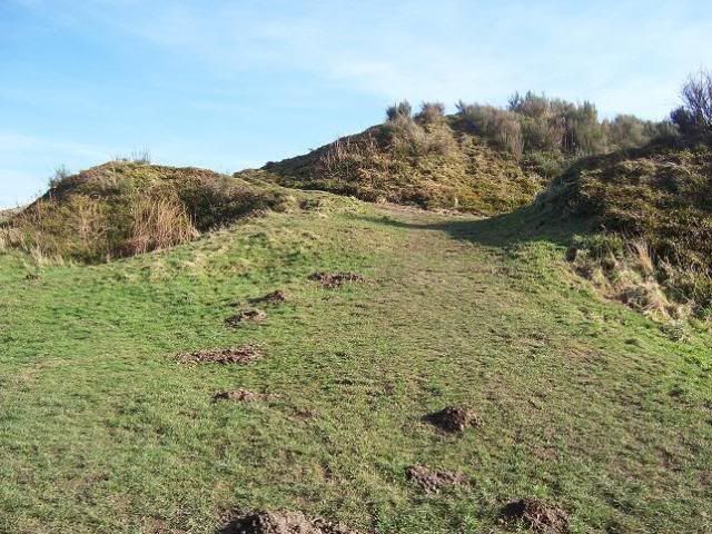
The technical term for a hillfort of this type is "multi-vallate", which reflects the multiple ramparts used as defense. Hillforts were often sited on hilltops or high ground generally, but sometimes they had to be built up, which seems to be the case here. The comparison with the later Norman ringwork type of castle is therefore quite a strong one.
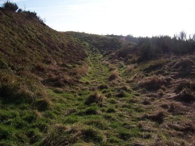
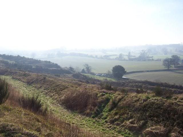
There is a unique feature to Old Oswestry that can be seen in the aerial photographs, a series of oblong holes within the ramparts at the western end. Nobody seems able to explain quite what their purpose was - water cisterns, storage hollows, or just further obstacles to confuse an invading enemy (or archaeologist...) The site was abandoned with the arrival of the Romans, and has lapsed into obscurity as most such sites did over the years, for a long time being covered in trees and so obscuring the ramparts from view.
The modern town of Oswestry, the third largest in Shropshire, is slightly to the west of the hillfort, and named after the Saxon King Oswald of Northumbria, who was killed in the battle of Maserfield (which is somewhere near here) in 642 while fighting King Penda of Mercia. Legend tells us that an eagle took his dismembered arm to a tree, which became the focal point of some miracles, named Oswald's Tree (y'see?) Oswald was, according to the Venerable Bede, one of the saintly Christian kings and so was later made a saint, with his feast day on 5 August. The local church is dedicated to St Oswald, naturally.

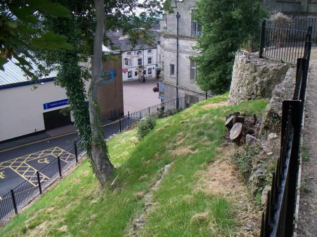
But there still wasn't much here. The Norman Conquest came and went, and Domesday Book tells us a chap called Reginald, the Sheriff of Shropshire, had "built the castle of Oswestry" in Maesbury, which was held by Roger de Montgomerie (the Marcher Lord of Shropshire) There will be more on Earl Roger in a later blog. Domesday Book also makes mention of little else here - "There is a church... There is a little wood rendering nothing." It seems that Norman Oswestry was, to begin with, just a motte-and-bailey castle, and nothing more...
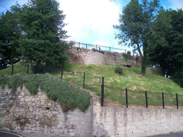
It was Henry I, grandson of William the Conqueror, who gave the lands of Oswestry to Alan fitzFlaad as a feudal barony, and in 1148 the castle was rebuilt in stone. From this, the borough of Oswestry began to grow. Alan's duties, in return, were basically to hold the border against the frequent Welsh incursions. And frequent they were. Shropshire has the densest concentration of castles of any British county, 32, possibly a combination of the fact it has a long border with Wales, and also Earl Roger was particularly ruthless in dealing with cross-border raids.

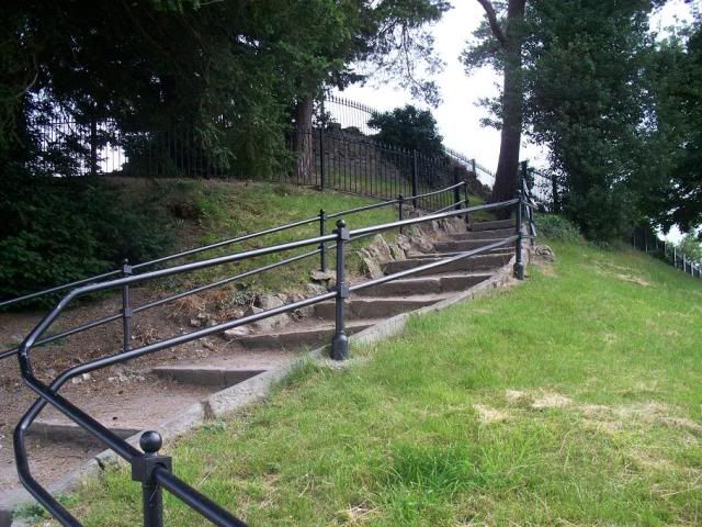
Oswestry Castle doesn't have all that much to look at today, granted, but I kinda like it, all the same!
The town was originally walled and gated, which didn't really help when the Welsh came raiding, and it was razed on at least two separate occasions in the fourteenth century and again early in the early fifteenth century. With the outbreak of the Civil War, Shropshire declared for the King, and Oswestry was besieged in 1644, after which the Parliamentarians tore down the walls and slighted the castle with some zeal.
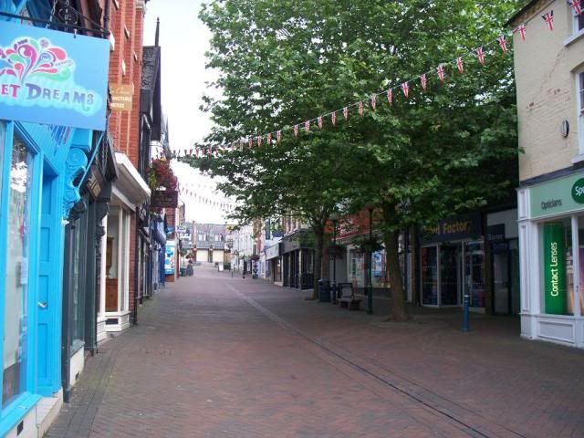
Wandering around the town now, you can still get a vague sense of the earlier town from the meandering streets that wind their way around and through the centre, but there aren't all that many sites of historical significance that shout out their presence, sadly.
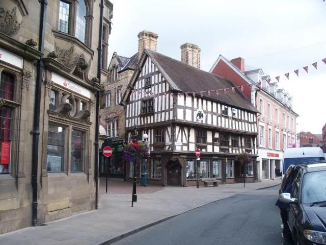

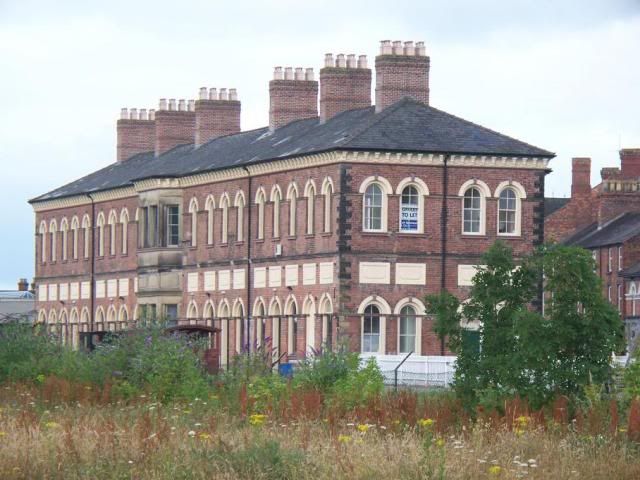
There are, of course, the odd exceptions! The town has a bit of a mix of architectural styles, reflecting the impact different eras had on it. Perhaps one of the more important things to happen to Oswestry was the coming of the railway in the Victorian era, when the town was on the main line of Cambrian Railways. Closed in 1966 thanks to Dr Beeching and his meddling, the headquarters building is now a railway museum.
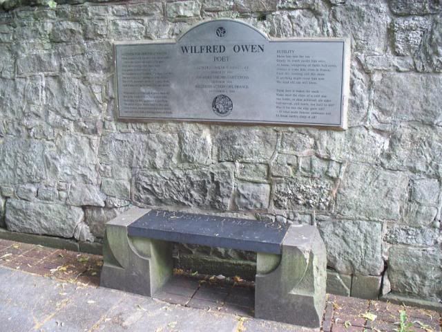
I didn't realise Wilfred Owen, the celebrated war-poet, was born here, actually:
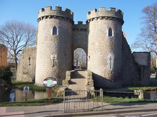
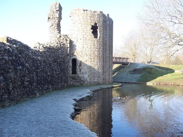
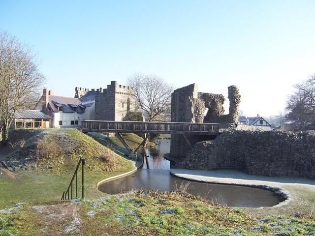
From Oswestry, we proceed east! First of all, we come to Whittington Castle.
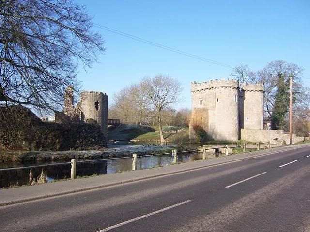
Believed to have started life as a Norman manor house, the lands were given to William Peverell, who was possibly an illegitimate son of William the Conqueror. It was originally constructed as a motte-and-bailey affair in around 1138 as a fortification against King Stephen during the Anarchy.
The castle had come into the FitzWarin family in 1204, and they were the ones largely responsible for its growth in this time. When the Welsh Prince Llywelyn the Great invaded England and occupied the Severn Valley, he destroyed the castle, but the FitzWarins regained their lands and rebuilt the castle in the 1220s in stone.
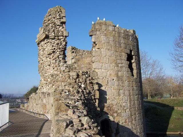
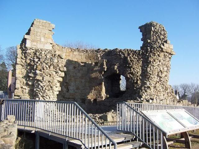
Despite the fact that it's in a very nice part of the country, Whittington Castle seems to have been neglected by its owners - in fact, the castle was swapped in 1545 with Henry VIII for some monastic land down in Devon. Somehow, you can't help but feel a little bit sorry for it! Particularly as the castle, as remodelled in the fourteenth century, is a very important example of English gardening habits. See, it is believed that, around this time, there were two elaborate gardens created, all fancy-like with water and such, with quite possibly the earliest-surviving viewing mound in England to survey them from (though the gardens have long gone):
At the time the castle was swapped, it was said to be in "much decay", and by the time of the Civil War was most likely indefensible anyway, so played no part. In 1760, one of the towers fell into the moat, which brought about the end really, when the majority of the castle was plundered for building stone, a lot going in to building the road to Ellesmere.
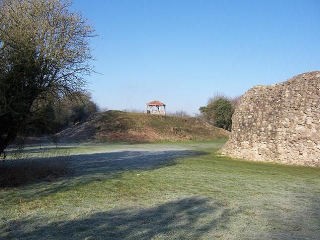
Which is where we end up next! Ellesmere started out in the eleventh century when a castle was built here by Earl Roger. Another border castle, Ellesmere traded hands at a rate of knots, at one time being ruled by Madog ap Maredudd, the last Prince of Powys, until in 1160 when Madog died (at Whittington!) it came into the hands of Henry II. When Llywelyn the Great married Joan, the daughter of King John in 1205, Ellesmere was given to them as a wedding gift.
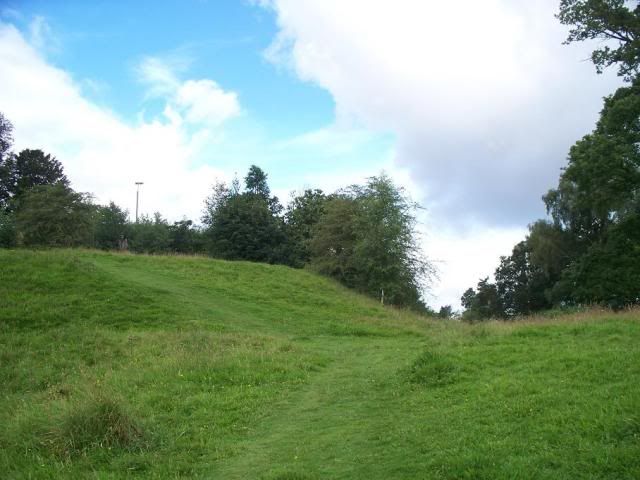
The castle was held by Llywelyn until his death in 1240, then passed to Henry III, who in turn entrusted it to the Lestranges of Knockin. By the fourteenth century, however, the castle was abandoned.
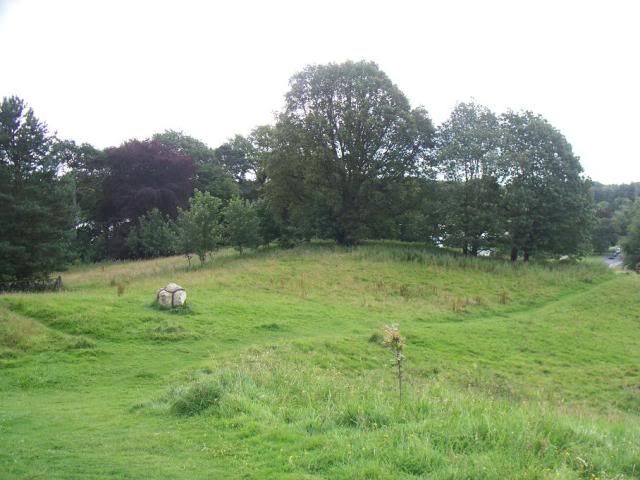
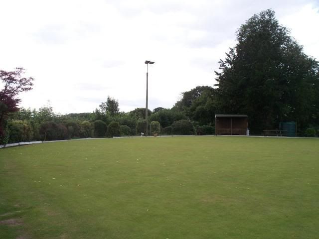
That is has been abandoned so long makes it all the more remarkable really that the earthworks have survived so well, I think! That said, the summit of the motte is crowned rather ignominously, with a bowling green:
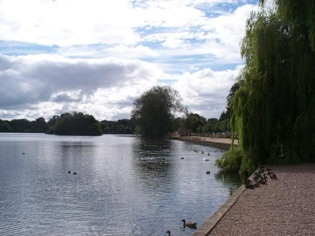
Ah well. Ellesmere is, of course, famous for its canal. Well, and the mere! The Ellesmere Canal links all of the industrial sites in Shropshire, providing transport between the Severn and the Mersey, terminating at the seaport of Ellesmere Port. The enterprise, presided over by no less a man than Thomas Telford, was never completed due to the railway boom, and the surviving sections became incorporated into the Shropshire Union Canal.
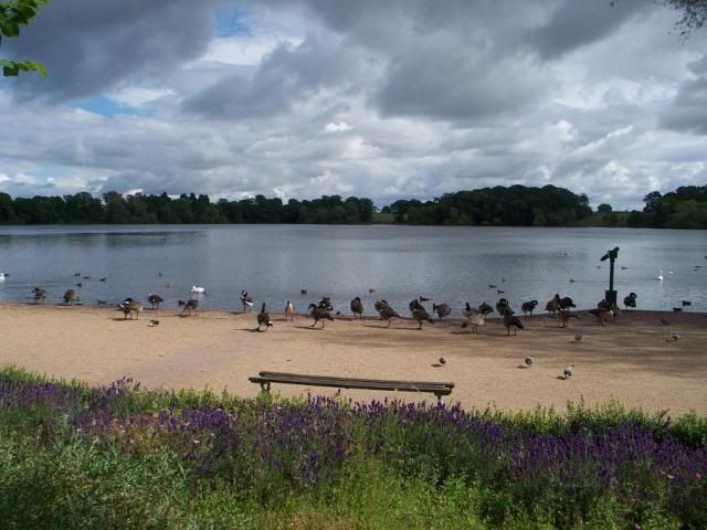
The mere at Ellesmere is one of the largest natural meres outside of the Lake District. A mere is simply a lake that is broader than it is deep, and the one at Ellesmere is one of nine glacial meres in the area.
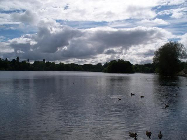
What is a glacial mere, I hear you all cry out? Well, I'm no geographer, but I'll try to explain. When the glaciers began to retreat during the end of the Ice Age (10000 years ago, apparently), it appears that most did so leaving behind pockets of ice in depressions between hills etc. These depressions, when the ice melted, formed glacial lakes, some of which have since dried up, but some remain to this day.
The mere at Ellesmere has in it an artificial island, created in 1812 when the gardens at Ellesmere House were being constructed. This island was named Moscow Island, in honour of Napoleon's forced retreat during the winter of 1812 (you all know the Tchaikovsky overture that celebrates this event, I'm sure...)
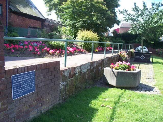
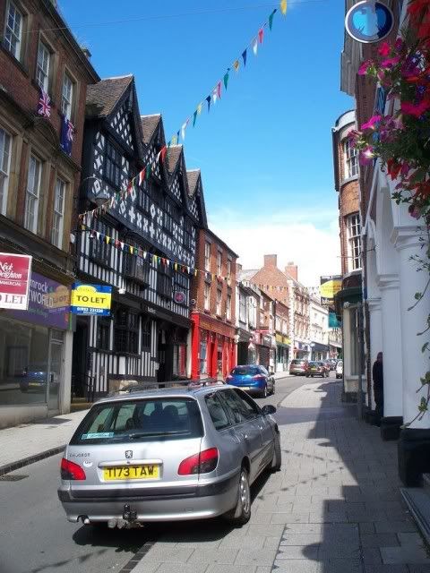
Onwards! I'm going to end this first leg of my Shropshire Summer Tour with the market town of Whitchurch. Signposted from pretty much everywhere, you'd be forgiven for thinking the town to be some sort of immense nexus of something, but it is actually just a quiet little border town that happens to be near a crossroads. It is, reputedly, the oldest continually-inhabited town in Shropshire, with a history going back to the first century AD under the Romans, when it was named Mediolanum. Very little of this period survives, though there is a wall course near the church that follows the line of one of the original forts here:
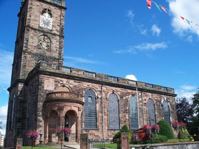
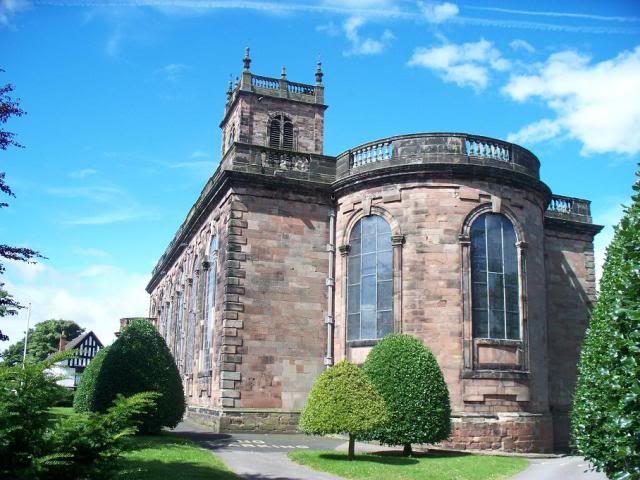
The town was called Westune in Domesday Book, held by William de Warenne, one of the chaps who is known to have fought at Hastings in 1066 and a name that frequently crops up in the Book. He was given A LOT of land post-conquest, including the landing site of Pevensey in Sussex. The town was reported as being worth £10 in 1086, with enough forest for fattening 400 pigs! The name of the town itself is believed to stem from the White Church that was built here in the Norman period, on the site of an earlier church, believed to have been founded in about 912. The present church of St Alkmund was rebuilt, after the medieval church collapsed, in 1712 and is quite striking for the massive windows it has (at least, I was struck!)
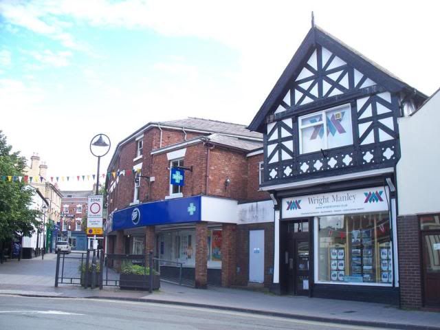
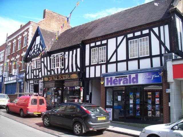
Wandering the streets of Whitchurch on a sunny Sunday morning, I was fleetingly reminded of my trip to Nantwich in June. There may not have been quite the proliferation of black-and-white buildings, of course, but still, it was most pleasant!

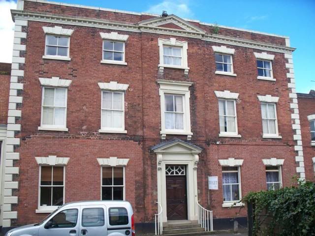


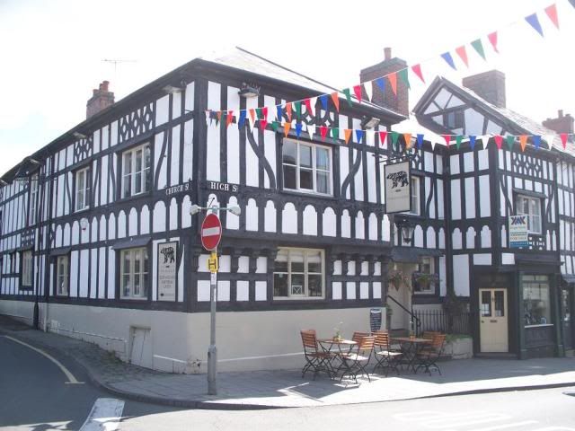
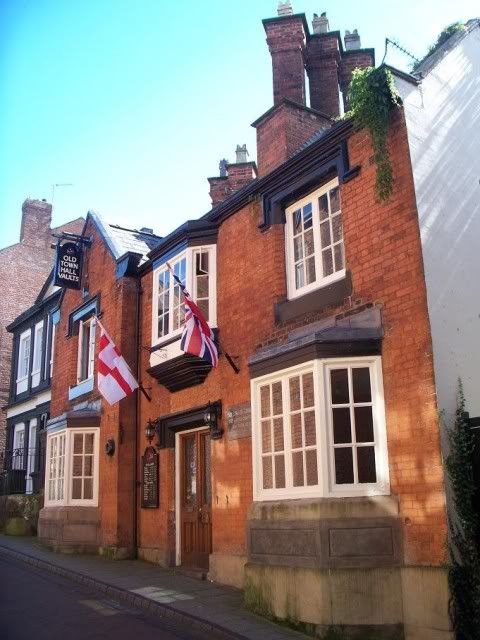
Whitchurch suffered badly during the Glyndwr rebellion (I'm sure that'll be a blog soon!), being almost completely destroyed in 1404. During the civil war, Whitchurch declared for the King and was taken by Parliamentarian forces in 1643. Prince Rupert himself led the recapture of the town the following year, no doubt with Boy cradled in his arm. Ah, Prince Rupert, what a barmy guy, riding into battle with a poodle under his arm! Anyway. Whitchurch was also the birthplace of the composer Edward German, famous for his English operas composed much in the same idiom as Arthur Sullivan (whose The Emerald Isle he completed). He was born in what is now the Old Town Hall Vaults pub:
So there we have it, that's trip one of my planned Shropshire Summer out of the way! I do hope you enjoyed it as much as I did - and don't forget to check back again soon for more thrilling installments!!!
No comments:
Post a Comment